
Sangetsar Tso (Madhuri Lake): A Journey Through Himalayas, Bollywood, and Borders
The Eastern Himalayas constitute one of the most formidable and geopolitically sensitive landscapes on Earth. Nestled within this rugged topography in Arunachal Pradesh’s Tawang district is Sangetsar Tso—a high-altitude lake that captures the imagination of spiritual pilgrims, military strategists, and modern tourists alike.
Colloquially known today as “Madhuri Lake,” Sangetsar Tso sits at a towering altitude between 12,165 and 12,500 feet. The transformation of this site from a quiet, high-altitude summer pasture for indigenous Monpa shepherds to a highly regulated, militarized, and sought-after tourist destination provides a fascinating look into cultural geography and borderland infrastructure.
Tectonic Genesis: How the Lake Was Born
The formation of high-altitude lakes in the Himalayas is almost exclusively a byproduct of the region’s intense tectonic activity. Sangetsar Tso is a direct, visible manifestation of this volatile geomorphology.
While the massive 1950 Assam-Tibet earthquake drastically altered the topography of the Eastern Himalayas, local accounts attribute the final creation of Sangetsar Tso in its current form to a devastating earthquake (or subsequent flash flood) in 1971. This seismic event caused massive landslides that dislodged rocks, boulders, and entire tracts of pine forest. The debris completely dammed the natural flow of the local Taktsang Chu river, drowning the pastoral land.
The most striking visual evidence of this violent genesis is the dense cluster of dead pine tree trunks still standing upright, protruding through the lake’s surface. Because the water temperature remains near freezing for much of the year, the submerged trunks have resisted rapid decomposition, serving as a haunting ecological monument to the submerged forest.
The Riverine Network
Sangetsar Tso is a dynamic component of the Taktsang Chu river basin, acting as a natural high-altitude reservoir. Approximately 13 kilometers downstream, the river converges with the much larger Nyamjang Chu, which eventually flows into Bhutan and merges with the Manas River, a major tributary of the Brahmaputra.
Spiritual Geography: Buddhism and the Vajrayana Lineage
To evaluate Sangetsar Tso strictly through a geological lens is to ignore the profound spiritual geography of the region. The indigenous Monpa community reveres high-altitude water bodies as the dwelling places of powerful natural spirits and deities.
The spiritual potency of the Sangetsar Tso region is inextricably linked to Guru Padmasambhava (Guru Rinpoche), the eighth-century Indian tantric master who transmitted Vajrayana Buddhism to the Himalayas.
Approximately 2.4 kilometers west of the lake, perched precariously on a cliff edge, lies the Taktsang Gompa (Tiger’s Den Monastery). According to local tradition, Guru Padmasambhava meditated in a specific cave just behind the main monastic complex. The lake and the monastery form a unified pilgrimage circuit; visitors frequently combine a trek to the Gompa with a period of reflection at the lake, walking around the water in a clockwise direction while prayer flags flutter in the wind.
The Pop Culture Phenomenon: The Birth of “Madhuri Lake”
While the local Monpa population and Buddhist pilgrims recognize the lake as Sangetsar Tso, the broader Indian tourism market recognizes it almost exclusively as “Madhuri Lake.”
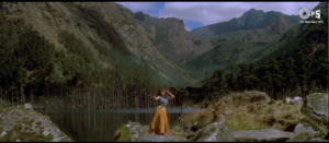
In 1997, the Bollywood film Koyla, starring Shah Rukh Khan and Madhuri Dixit, was filmed extensively in the Tawang region. The director utilized the dramatic, stark landscape of Sangetsar Tso for a major musical sequence. Following the immense box-office success of the movie, domestic tourists began flocking to the site, colloquially renaming it after the lead actress.
Today, the name “Madhuri Lake” is universally used by taxi drivers, local guides, tour operators, and even features prominently on official tourism portals.
Strategic Geopolitics and Border Militarization
Sangetsar Tso is located in one of the most heavily militarized zones in the world. Situated mere miles from the Line of Actual Control (LAC) that separates India and China, the lake operates under a strict security paradigm.
The geopolitical reality of the Tawang district was forever altered by the 1962 Sino-Indian War. The region witnessed intense combat, immortalized by the heroic stand of Indian soldiers such as Rifleman Jaswant Singh Rawat. Today, approximately 6.4 kilometers east of the lake lies the Bum La Pass (15,200 feet), a critical strategic border point. Almost all tourist itineraries combine a highly regulated visit to Bum La Pass with a stop at Sangetsar Tso, accessed via a heavily guarded military bifurcation point known as the “Y-Junction.”
The Sela Tunnel: A Paradigm Shift in Logistics
Historically, accessing Tawang required traversing the infamous Sela Pass at 13,700 feet—a perilous journey fraught with hairpin bends, black ice, and prolonged winter closures.
This logistical nightmare was resolved with the inauguration of the Sela Tunnel in March 2024 by the Border Roads Organisation (BRO). Located at 9,800 feet, it is the longest bi-lane tunnel in the world at this altitude reference. By bypassing the treacherous snow line, the tunnel guarantees all-weather, year-round connectivity to the border areas, drastically cutting travel time and sparking a surge in civilian travel to Sangetsar Tso.
Navigating the Tourist Corridor: Logistics and Acclimatization
The journey to Sangetsar Tso remains a test of endurance and logistical planning.
The Regulatory Framework
-
Inner Line Permit (ILP): All Indian citizens from outside Arunachal Pradesh must obtain an ILP to enter the state.
-
Bum La / Sangetsar Military Clearance: To travel north of Tawang town toward the lake, visitors require a special local permit issued by the Deputy Commissioner and explicitly stamped by the Indian Army. Without this stamp, civilian vehicles will be turned back.
The Route
The lake is located approximately 35 to 37 kilometers from Tawang town. Because the roads degrade into mud tracks and rock beds, the journey takes 1.5 to 2 hours one-way. Government buses do not operate here; visitors must hire robust, high-clearance SUVs (like Tata Sumos or Mahindra Boleros) driven by experienced locals.
| Route Segment | Approximate Distance | Estimated Drive Time |
| Tawang Town to PT Tso | ~17 km | 45 – 60 minutes |
| Tawang Town to Y-Junction | ~20-25 km | 1 – 1.5 hours |
| Y-Junction to Bum La Pass | ~10-14 km | 30 – 40 minutes |
| Y-Junction to Sangetsar Tso | ~15 km | ~30 minutes |
| Tawang Town to Sangetsar Tso (Total) | ~35-37 km | 1.5 – 2 hours |
Standard Itinerary: Tourists usually depart Tawang in the morning, stop for photos at Pankang Teng Tso (PT Tso), and reach the Y-Junction. From there, they proceed to Bum La Pass to view the LAC before returning to the Y-Junction and descending to Sangetsar Tso.
Army Hospitality and Altitude Risks
Recognizing the extreme cold and lack of commercial infrastructure, the Indian Army has established visitor facilities. At the Y-Junction and near the lake, Army-run canteens provide heavily subsidized hot tea, samosas, and Maggi. The Army also maintains the ‘Shungatser Hut’ on the lake’s banks.
However, the physical risks are severe. Sitting above 12,000 feet, the risk of Acute Mountain Sickness (AMS) is high. Visitors are urged to acclimatize in Tawang town for at least a day, move slowly, stay hydrated, and carry supplemental oxygen if necessary. Heavy winter layering is essential year-round due to the bitter winds.
Conclusion
Sangetsar Tso is a geographical anomaly born of violence—the violent tectonic uplift of the Himalayas and catastrophic seismic damming. Yet, from this violent genesis emerged a landscape of profound serenity.
To the indigenous Monpa and Buddhist pilgrims, it is a sacred space sanctified by Guru Padmasambhava. To the Indian Army and the BRO, it is a logistical waypoint in a high-stakes geopolitical theater. To millions of domestic tourists, it is the cinematic fantasy of “Madhuri Lake.”
As new all-weather tunnels make the lake more accessible than ever, the ultimate challenge will be preserving this delicate alpine ecosystem. Ensuring that the skeletal pines of Sangetsar Tso continue to reflect in pristine waters will require a careful balance between national security, economic tourism, and rigorous ecological stewardship.