
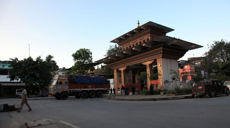
The Fascinating Story of Jaigaon & Bhutan
The Gateway to the Last Himalayan Kingdom
History of Bhutan
The geopolitical and cultural trajectory of Bhutan is deeply rooted in its geographic isolation and its rich spiritual heritage. Archaeological evidence, including the discovery of stone adzes (known locally as namchag) and megalithic structures (doring), suggests that the region—historically referred to as Lhomon or Mon Yul, the “dark country” of the southern Mon people—was inhabited as early as 2000 BCE1. The modern identity of Bhutan began to crystallize in the seventh century CE when the Tibetan King Songtsen Gampo extended the Tibetan Empire southward, constructing the first Buddhist temples in the region to pin down a mythological demoness whose body allegedly spanned the Himalayas1. By the eighth century, the arrival of the exiled Indian king Sindhu Rāja and the revered Indian saint Padma Sambhava (Guru Rinpoche) firmly established Vajrayana Buddhism, laying a philosophical and cultural foundation that continues to dictate the nation’s political and social life1.
For centuries, the territory was a patchwork of warring fiefdoms dominated by regional lords and rival Buddhist subsects, which vied for supremacy and patronage from shifting external powers, including the Mongol warlords and the Yuan dynasty1. It was not until 1616 that Zhabdrung Ngawang Namgyal, a Tibetan lama fleeing persecution, arrived in the region. He successfully unified the disparate valleys into a single state called Druk Yul (Land of the Thunder Dragon), defeated multiple Tibetan invasions, and codified the Tsa Yig legal system1. To govern this unified territory, the Zhabdrung established a dual system of government shared by a secular administrative leader, the Druk Desi, and a supreme spiritual head, the Je Khenpo1. This complex theocratic and civil administrative structure provided the resilience necessary to maintain a sovereign identity distinct from its Himalayan neighbors.
Why Bhutan remained independent while many Himalayan kingdoms disappeared
The survival of Bhutan as an independent nation—while neighboring Himalayan kingdoms like Tibet were incorporated into the People’s Republic of China, and Sikkim was absorbed by India—is a testament to its formidable topography, strategic statecraft, and tactical diplomatic concessions2. Unlike Tibet, which relied heavily on isolationism, or Sikkim, which fell victim to internal demographic and political fracturing, Bhutan aggressively guarded its sovereignty by knowing exactly when to fight and when to negotiate5.
Bhutan’s independence in the modern era was preserved largely through a highly pragmatic approach to British imperialism. Recognizing the overwhelming military superiority of British India following the devastating Duar War of 1864–1865, Bhutanese leadership strategically ceded the fertile lowland plains in exchange for internal autonomy and a critical annual financial subsidy11. The subsequent emergence of the Wangchuck dynasty in 1907 brought unprecedented internal stability, replacing the fractured and often violent rule of regional governors known as Penlops1. King Ugyen Wangchuck secured the 1910 Treaty of Punakha, which formally guaranteed British non-interference in Bhutan’s internal affairs in exchange for British guidance on external relations1. Following India’s independence, this delicate arrangement was renegotiated through the 1949 Treaty of Darjeeling, which permanently recognized Bhutanese sovereignty1. By effectively serving as a reliable, peaceful buffer state between the massive geopolitical entities of India and China, Bhutan transformed its geographical vulnerability into an enduring mechanism for geopolitical survival.
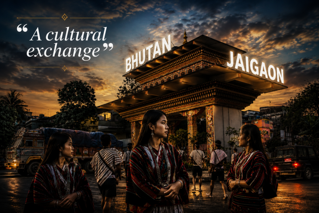
How Jaigaon became India’s gateway to Bhutan
Before the mid-twentieth century, the area that is now Jaigaon was a sparsely populated expanse of dense subtropical forests and malarial plains inhabited primarily by the indigenous Mech tribes, who practiced slash-and-burn agriculture and maintained semi-nomadic lifestyles16. Its transformation into a vital commercial gateway was triggered by tectonic geopolitical shifts following India’s independence and the subsequent sealing of the Indo-Tibetan borders after the 1959 Tibetan uprising2.
When Bhutan emerged from centuries of self-imposed isolation to launch its ambitious First Five-Year Plan in 1961, it required a massive influx of construction materials, raw goods, and labor to build its foundational infrastructure7. Jaigaon, situated directly opposite the Bhutanese border town of Phuentsholing at the edge of the Duars plain, organically evolved into the primary logistical staging ground for this modernization effort16. The 1972 Agreement on Trade and Commerce between India and Bhutan further catalyzed this growth by establishing a free-trade regime and allowing the duty-free transit of Bhutanese exports to third countries through Indian territory16. As Bhutan’s economy expanded—fueled by massive Indian financial assistance and the development of lucrative hydropower projects—Jaigaon transformed from a peripheral forest outpost into India’s most critical Land Customs Station for trans-Himalayan trade, handling the overwhelming majority of bilateral exchanges16.
Modern India-Bhutan relationship
Today, the bilateral relationship between India and Bhutan is characterized by deep economic integration, strategic security cooperation, and shared geopolitical anxieties. India remains Bhutan’s largest trading partner by a vast margin, accounting for over 80% of Bhutan’s overall trade volume. Bilateral trade reached an impressive USD 1,777.44 million in the 2024–2025 fiscal year18. The absolute cornerstone of this economic relationship is hydropower; Bhutan exports massive quantities of surplus electricity to India, which accounts for a substantial portion of its national revenue, while importing fuel, industrial machinery, and essential agricultural commodities18.
| Economic Indicator (2024-2025) | Value (USD Millions) |
| Indian Exports to Bhutan | 1,264.00 |
| Indian Imports from Bhutan | 513.44 |
| Total Bilateral Trade | 1,777.44 |
| Balance of Trade | 750.56 (In India’s Favor) |
Data reflecting the deep macroeconomic interdependence between the two nations.
[cite: 18]
Beyond trade, the modern relationship is rapidly evolving to address new demographic and strategic realities. Bhutan is currently battling a severe demographic crisis, with an estimated 9% of its population migrating overseas—primarily youth leaving in search of better economic opportunities—leading to a severe “hollowing out” of its workforce and civil service23. To counter this existential threat, King Jigme Khesar Namgyel Wangchuck has launched the Gelephu Mindfulness City (GMC)—a massive, 2,500-square-kilometer Special Administrative Region on the Assam border23. Guided by Buddhist principles of biophilic design and carbon-negativity, the GMC is intended to attract global capital, foster green industries, and serve as an economic bridge between South Asia and Southeast Asia25. India has heavily backed this initiative, viewing it as a vital strategic investment to counter Chinese influence. New Delhi has committed to building multi-modal logistics hubs, new railway links connecting Assam to Gelephu, and an infusion of ₹10,000 crore for Bhutan’s upcoming Five-Year Plan, ensuring that India remains the indispensable anchor of Bhutanese modernization23.
One Border, Two Futures
“Two cities separated by a gate. Why did they develop so differently?”
Economy
The economic divergence between Jaigaon and Phuentsholing is a profound study in contrasts between formal corporate consolidation and informal, high-velocity trade dynamism. Phuentsholing operates as the undisputed financial, industrial, and trading capital of Bhutan29. It houses the headquarters of the Bank of Bhutan and serves as the corporate base for the nation’s major trading houses. Its economy is highly regulated and outward-facing, focusing on the large-scale export of ferro-silicon, dolomite chips, and hydropower, while systematically managing the formal import of industrial machinery and high-speed diesel18.
Jaigaon, conversely, operates as a high-volume, low-margin wholesale and transit economy. It thrives entirely on the informal, everyday needs of Bhutanese consumers who cross the border to purchase cheaper Indian textiles, electronics, FMCG products, and groceries16. The Indian border town’s economy is entirely derivative of Bhutanese demand; prior to the pandemic, daily wholesale and retail transactions in Jaigaon approached ₹2 crore, a figure that plummeted to near zero when Bhutan sealed its borders, devastating local merchants32. Furthermore, the Jaigaon economy is heavily reliant on logistics, with hundreds of transport agencies and clearing and forwarding (C&F) agents operating truck fleets that move goods from the Indian railheads of Hasimara and Bagdogra into the Himalayan interior34.
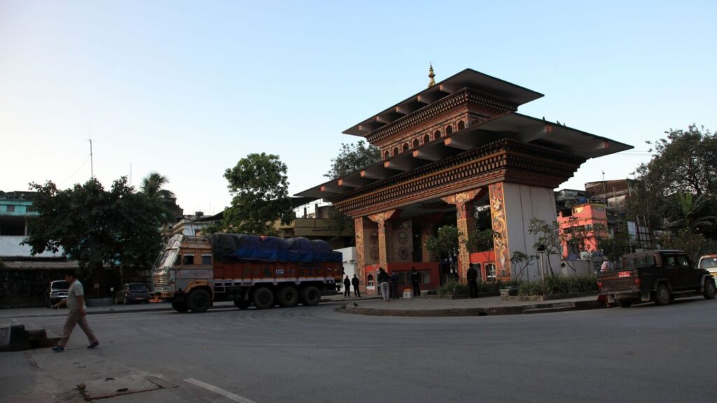
Urban planning
The architectural and spatial realities of the two towns represent fundamentally opposed philosophies of urban governance. Phuentsholing is guided by a highly structured master plan, the Phuentsholing Structure Plan 2013-2028, which integrates Local Area Plans (LAPs) driven by intense scientific terrain analysis9. Recognizing its severe vulnerability to landslides, fragile soils, and riverine floods, Phuentsholing has adopted a “Nature First” approach. The city enforces strict Development Control Regulations (DCR) that mandate riparian setbacks, green ecological corridors, and traditional Bhutanese architectural harmonization9. The municipality utilizes mechanisms like land pooling to secure public infrastructure space without resorting to forced acquisitions or massive public budgets, ensuring orderly and resilient growth10.
Jaigaon, restricted historically by Indian laws limiting the formal development of towns on international borders, sprang up illegally and grew organically for decades before attaining its current census town status16. It remains an unincorporated entity without a proper municipality, governed only by the Jaigaon Development Authority and three local gram panchayats36. This glaring administrative void has resulted in a chaotic, suffocating urban fabric. The town is characterized by narrow, permanently congested roads, haphazard multi-story concrete structures lacking any environmental setbacks, and a critical absence of civic amenities, including the lack of a proper hospital, which forces residents to travel up to 35 kilometers for basic medical treatment16.
Cleanliness
The disparity in municipal management is most viscerally evident in environmental cleanliness. Phuentsholing is universally noted by travelers for its pristine, litter-free streets, manicured parks, and minimal noise pollution—a direct result of strict civic enforcement and cultural norms against vehicular honking37. The Bhutanese city actively manages its watershed through Payment for Environmental Services (PES) schemes, where urban residents contribute a portion of their water tariff to upstream rural communities to ensure the protection of the hydrological basin.
Conversely, Jaigaon is literally suffocating under its own refuse. The town lacks any functional solid waste management system, resulting in the daily, unregulated dumping of plastic, household, and medical waste directly onto the banks and dry beds of the Torsa River36. During the monsoon, this massive accumulation of refuse is washed downstream into the ecologically sensitive floodplains of the Jaldapara National Park, directly endangering local wildlife, including Indian one-horned rhinos and elephants40. The open burning of garbage in Jaigaon creates persistent toxic smoke, leading to severe respiratory issues, nausea, and chronic illness for its residents—a stark, tragic contrast to the ecological mindfulness mandated just hundreds of meters away across the Bhutan Gate43.
Culture
Phuentsholing is a carefully curated reflection of Bhutanese national identity. Buildings are legally mandated to feature traditional Bhutanese motifs, and public life is heavily influenced by the nation’s profound Buddhist heritage. This is highly visible in structures like the Zangto Pelri Lhakhang, situated in a beautifully maintained public park, and the Karbandi Monastery overlooking the Bengal plains9. While significantly more cosmopolitan and industrial than the Bhutanese interior, Phuentsholing remains a culturally homogenous space that prioritizes order, spiritual reverence, and tradition31.
Jaigaon, by contrast, is a chaotic, vibrant microcosm of pan-Indian diversity. It is a demographic melting pot shaped entirely by decades of economic migration. According to census data, the town’s population comprises Bengalis (40.2%), Nepalis (23.6%), Hindi speakers (12.3%), Bhojpuri speakers (11.2%), and Marwaris (1.62%), alongside the indigenous Rajbongshi population30. The culture of Jaigaon is purely transactional; it is a frontier settlement where language, cuisine, and customs blur into a singular, relentless pursuit of commercial survival, entirely devoid of the state-sponsored cultural engineering seen across the gate44.
Happiness
Bhutan’s unique development paradigm is famously anchored in Gross National Happiness (GNH), a philosophy which argues that holistic well-being—encompassing sustainable socio-economic development, cultural preservation, and environmental conservation—is fundamentally superior to the sheer accumulation of Gross Domestic Product19. Phuentsholing, despite being Bhutan’s commercial engine, is heavily regulated to ensure it aligns with these GNH mandates, balancing industrial output with high standards of public livability39.
In Jaigaon, happiness is measured strictly by economic metrics. The town’s residents endure severe infrastructural deficits, rampant criminal extortion, and catastrophic environmental degradation in exchange for the highly lucrative opportunities afforded by cross-border trade30. The psychological reality of Jaigaon is one of perpetual hustle, defined by the precariousness of living adjacent to a sovereign border that can be shut at a moment’s notice, instantly decimating the local economy and leaving thousands without a livelihood50.
The Secret Lifeline of Bhutan
What if this small Indian town stopped functioning for a single day?
Most goods entering Bhutan pass through this route
Because Bhutan is a landlocked, highly mountainous nation with minimal domestic manufacturing capabilities, its survival is entirely tethered to Indian imports. The Jaigaon-Phuentsholing corridor is the absolute epicenter of this dependency. While Bhutan shares 13 active land corridors with India, this specific gateway handles an overwhelming 75% to 90% of Bhutan’s total bilateral trade volume16. If Jaigaon were to cease functioning for a single day, the immediate macroeconomic ripple effects across Bhutan would be profound. The flow of essential petroleum products—particularly High Speed Diesel (HSD) and motor spirit, which account for billions of Ngultrum in imports—would halt, crippling domestic transportation and logistics22. The supply chains for the massive Pasakha Industrial Estate, Bhutan’s heavy industry hub, would instantly run dry of vital raw materials, stalling national production20.
Trade trucks
The physical manifestation of this lifeline is the endless convoy of heavy-duty trucks navigating the National Highway 317A spur toward the border55. Historical traffic data indicates that hundreds of multi-axle trucks cross this specific border daily, moving over 1.1 million tons of imports and half a million tons of exports annually54. The sheer volume of this freight traffic, which includes everything from massive shipments of semi-milled rice to IT processing units, frequently overwhelms Jaigaon’s inadequate infrastructure, leading to perpetual, choking gridlock22. To mitigate this severe bottleneck, authorities have initiated the construction of a mega dry port (MDP) at Pasakha and an alternative Land Customs Station at Ahlay, aiming to divert heavy industrial freight away from the fragile commercial centers of Jaigaon and Phuentsholing20.
Border economy
The border economy operates on a unique financial symbiosis designed to eliminate friction. To facilitate seamless commerce, the Bhutanese Ngultrum is pegged at absolute par with the Indian Rupee (1:1), and Indian currency is widely accepted throughout Bhutanese markets, though larger denominations frequently face restrictions18. However, this deeply interconnected economy also breeds sophisticated exploitation. The Indian Goods and Services Tax (GST) framework provides lucrative refunds for goods formally exported to Bhutan. A sophisticated nexus of racketeers based in Jaigaon has been documented generating fake invoices, claiming hundreds of crores in GST refunds for goods—such as pan masala, tires, and electronics—that are shown on paper as exports to Bhutan, but are instead illegally diverted and sold at cheap prices in domestic Indian markets58.
Local workers
Beneath the macroeconomic trade figures lies an invisible, highly vulnerable army of local workers. Jaigaon sustains thousands of loaders, truck drivers, freight forwarders, and clearing agents whose daily survival is entirely tethered to the physical movement of goods across the border21. Furthermore, because Indian labor is significantly cheaper, Bhutanese construction sites and retail businesses rely heavily on Indian daily wage workers who cross the pedestrian terminal every morning and return to Jaigaon at night16. When the border was abruptly sealed during the COVID-19 pandemic, this entire labor ecosystem collapsed instantly, triggering a desperate exodus of over 2,000 traders and laborers back to their home states in India50.
The Town That Lives Between Two Nations
What does it feel like to live in a place where two countries are part of everyday life?
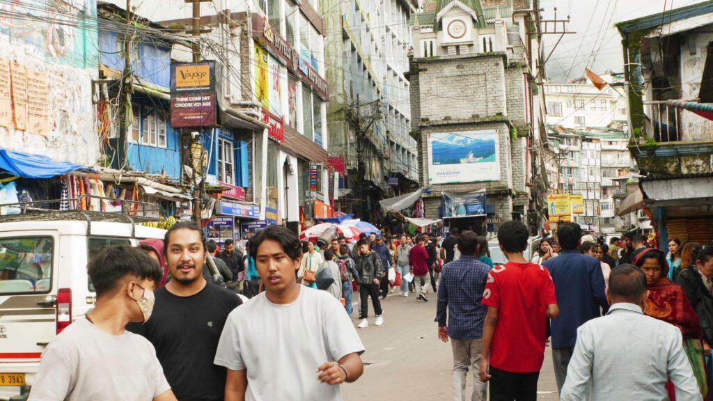
Shopkeepers
For the shopkeepers of Jaigaon, Bhutan is not a foreign nation; it is the sole consumer base. Up to 6,000 medium-scale traders in Jaigaon rely implicitly on Bhutanese citizens crossing the border to purchase weekly rations, textiles, hardware, and cosmetics32. The integration is so deep that it has spawned a highly localized, grey-market financial nexus. Because popular Indian digital payment systems like Paytm and Google Pay are largely inaccessible to Bhutanese citizens due to banking regulations, Jaigaon shopkeepers have established illicit partnerships with Bhutanese nationals in Phuentsholing. These Indian merchants utilize their Bhutanese friends’ bank accounts (such as MBoB) to accept digital payments in Ngultrum directly from their customers. In exchange, they pay a monthly commission of around 2% to the Bhutanese account holders to seamlessly repatriate the funds, operating a shadow financial network that bypasses formal banking bottlenecks59.
Drivers
For the transport operators and taxi drivers based in the border region, the physical boundary dictates the total rhythm of life. Transporting goods or tourists into the Bhutanese interior requires navigating a complex web of permits, regulations, and environmental taxes. Indian-registered vehicles are permitted within the immediate border zone of Phuentsholing without charge, but venturing beyond the Rinchending Check Post incurs a steep Green Tax of 4,500 Ngultrum per day60. Furthermore, drivers must constantly ensure their vehicles are less than ten years old, possess valid emission certificates, and are heavily monitored through Bhutan’s Check Post Management System (CPMS)13. The mountainous topography beyond the border further demands immense driving skill, contrasting sharply with the flat, predictable plains of West Bengal29.
Students
The border also serves as a porous educational membrane, facilitating a unique form of cross-border human capital exchange. Because of the limited availability of affordable international and Central Board of Secondary Education (CBSE) schools within Bhutan, hundreds of Bhutanese students historically crossed into Jaigaon daily to attend institutions like the SHMD School30. The Bhutanese government, recognizing the threat of this continuous brain drain, is now aggressively attempting to modernize its own educational landscape to retain this talent. Initiatives such as partnering with international entities to open elite K-12 institutions, like the EtonHouse Bhutan International School, are currently underway, aiming to bridge global academic standards with traditional Gross National Happiness values without requiring students to leave the country49.
Border workers
The border is meticulously managed by a dual, highly coordinated apparatus: the Sashastra Seema Bal (SSB) on the Indian side, and the Royal Bhutan Army operating alongside Bhutanese immigration officials29. The recent implementation of a 24/7 automated pedestrian terminal in Phuentsholing marks a massive technological leap in managing this intense human flow20. Utilizing sophisticated e-gates, pre-registered biometrics, and QR code tracking, the terminal processes thousands of daily commuters—including over 7,000 Bhutanese nationals and thousands of Indian casual visitors on a given day—balancing rigorous national security protocols with the absolute necessity of unhindered economic friction50.
The Forgotten Frontier of the British Empire
Before this was a border town, it was part of a much bigger imperial story.
British India
The modern boundary separating the chaotic streets of Jaigaon from the pristine avenues of Phuentsholing is a highly artificial construct born of British imperial ambition. In the eighteenth and nineteenth centuries, the British East India Company, having consolidated ruthless control over the plains of Bengal and Assam, began casting its gaze northward15. The British sought to secure the lucrative tea-growing regions of the Himalayan foothills and desperately sought unhindered trade access to the legendary, untapped markets of Lhasa in Tibet15. Standing squarely in their way was Bhutan, a decentralized but fiercely independent kingdom that exerted traditional, unyielding control over the Duars—a vital stretch of fertile lowland passes that served as the primary gateways between the Himalayan heights and the Indian plains13.
Himalayan trade routes
The initial British approach to the region was strictly commercial and diplomatic. In 1774, the East India Company dispatched the historic Bogle Mission to establish formal communication and trade links with Bhutan and Tibet, resulting in a fragile peace treaty that granted the British symbolic timber rights while temporarily stabilizing the frontier11. However, the immense economic value of the 18 Duars—which provided critical agricultural revenue necessary to fund the endless internal power struggles of Bhutanese regional governors (Penlops)—made future conflict inevitable. As the British aggressively expanded their highly profitable tea plantations directly into these contested foothill zones, the Bhutanese fiercely resisted the encroachment13.
Bhutan-British conflicts
Tensions escalated violently throughout the early nineteenth century as Bhutanese forces repeatedly raided British-protected territories in Assam, Cooch Behar, and Sikkim. These raiding parties, directed by local Bhutanese fort governors, carried off livestock, extracted heavy tributes, and took hundreds of captives to serve as slave labor, deeply humiliating the British administration37. In 1863, the British dispatched envoy Ashley Eden to negotiate a definitive border settlement. Arriving amidst a brutal Bhutanese civil war, Eden was treated with extreme hostility by the powerful Trongsa Penlop, Jigme Namgyal. Eden was physically insulted and forced under severe duress to sign a humiliating treaty utterly surrendering British claims to the Duars13.
Outraged, the British government immediately repudiated the extorted treaty and officially declared war in November 1864, assembling the heavily armed Duar Field Force13. The ensuing Duar War (Anglo-Bhutanese War) was marked by severe logistical disasters for the British, who faced dense malarial jungles, steep, impassable terrain, and fierce, unexpected resistance from Bhutanese fortress guards armed with antiquated matchlocks, catapults, and swords11. Under the brilliant tactical command of Jigme Namgyal, Bhutanese forces scored a stunning early victory at the Battle of Dewangiri (Deothang), successfully cutting off British water supplies, forcing a highly chaotic evacuation, and capturing two prized British howitzer guns11.
| Duar War (1864-1865) Key Engagements | Description |
| Ashley Eden Mission (1863-1864) | British envoy forced to sign a humiliating treaty by Bhutanese leadership under duress, triggering the casus belli.37 |
| Initial British Advance (Nov 1864) | Duar Field Force captures heavily defended frontier forts including Buxa, Dalimkote, and Dewangiri.11 |
| Bhutanese Counter-Offensive (Feb 1865) | Jigme Namgyal leads forces to recapture Dewangiri, isolating the garrison and seizing British artillery (howitzers).15 |
| British Recapture (April 1865) | Reinforced British units under General Tombs, featuring acts of valor by the 44th Sylhet Regiment, retake Dewangiri, destroying the fortress.11 |
How modern borders were create
Despite moments of extraordinary tactical brilliance, the technologically outmatched, internally divided Bhutanese could not sustain a protracted war of attrition against the limitless resources of the British Empire43. The conflict officially concluded with the signing of the Treaty of Sinchula on November 11, 186511. Under its punishing terms, Bhutan was forced to permanently cede the Assam Duars, the Bengal Duars (which includes the modern territory upon which Jaigaon sits), and a massive tract of Kalimpong to British India in perpetuity11. In exchange, the British provided Bhutan a humiliating but necessary annual subsidy of 50,000 rupees11. This treaty brutally drew the definitive, unyielding cartographic line that exists today, forever severing the Bhutanese highlands from their historical lowland economic zones and giving birth to the modern border geography of Jaigaon and Phuentsholing37.
Beyond the Gate: The Untold Story of Jaigaon
Millions pass through this border. Almost nobody knows the story of the town itself.
How Jaigaon grew
Before the 20th century, the area that is now Jaigaon was a sparsely populated expanse of dense subtropical forests in the Dooars region, characterized by harsh, malarial conditions16. It was primarily inhabited by indigenous tribal groups, notably the Mech (a Bodo-Kachari subgroup), who maintained semi-nomadic lifestyles and practiced slash-and-burn agriculture while navigating pressures from wildlife like elephants and tigers16. Historically, Bhutanese administrative outposts exerted significant cultural and economic sway over this frontier, fostering informal cross-border barter of timber, herbs, salt, and livestock long before formalized trade structures existed16. Following the Duar War of 1864–1865, the region was permanently stripped from Bhutanese control and absorbed by British India via the Treaty of Sinchula, though it remained a peripheral, largely ignored forest outpost for nearly another century13.
Jaigaon’s true urban transformation began following India’s independence and the signing of the Indo-Bhutan Treaty of Peace and Friendship in 1949, which affirmed open borders and preferential trade16. The town’s deep physical isolation was finally broken by the construction of the National Highway 317A spur, connecting the border directly to Indian arterial roads near Hasimara55. When Bhutan launched its First Five-Year Plan in 1961 to modernize its infrastructure, Jaigaon transitioned rapidly from a rudimentary agrarian settlement into a crucial logistical staging ground16. The 1972 Agreement on Trade and Commerce between India and Bhutan formalized a free-trade regime, cementing Jaigaon’s role as the primary land customs station for duty-free transit16. Later, the massive liberalization of the Indian economy in 1991, coupled with updated Indo-Bhutan trade protocols in 1995, unleashed a torrent of unregulated commercial expansion, transforming Jaigaon into the chaotic, sprawling transit hub it is today16.
Migration
This sudden commercial explosion drove massive waves of internal Indian migration. Seeking highly lucrative opportunities in transport, clearing and forwarding, and retail, migrants poured into Jaigaon from across the subcontinent. Wealthy Marwari merchants from Rajasthan quickly established dominance over the town’s lucrative wholesale and hardware sectors30. Thousands of laborers from Bihar and Uttar Pradesh arrived to handle the grueling, physical logistics of border freight16. They joined existing populations of Nep Nepalis, Bengalis, and indigenous Rajbongshis, creating a highly transient, multi-ethnic demography where no single community possessed an overwhelming majority, and cultural roots remained exceedingly shallow compared to the deep, ancient historical continuity found across the border in Bhutan16.
Trade
Today, Jaigaon functions fundamentally as a town-sized warehouse. It exists entirely to hold, process, and forward goods. It serves as the primary staging ground for nearly all Indian products entering the Bhutanese market—ranging from automobiles and construction steel to perishable agricultural goods and electronics52. Furthermore, the recent introduction of Bhutan’s Sustainable Development Fee (SDF) of INR 1,200 per night for Indian tourists has profoundly reshaped Jaigaon’s local economy. Rather than paying the steep daily fee to stay overnight inside Bhutan, thousands of budget travelers now utilize the 42 hotels located inside Jaigaon as cheap basecamps, making daily pedestrian trips across the border, thereby creating a massive, secondary hospitality boom on the Indian side32.
| Bhutan Sustainable Development Fee (SDF) Structure (2024-2026) | Rate per night |
| International Tourists (Non-SAARC) | USD 10057 |
| Indian Nationals (Adults) | INR 1,20075 |
| Indian Nationals (Children 6-12) | INR 600 (50% Concession)77 |
| Children (Under 6) | Exempt65 |
Culture
Jaigaon’s culture is a frantic, purely transactional byproduct of its diverse demographics and its precarious geography. There is no overarching civic identity; instead, the town is a mosaic of linguistic and regional enclaves surviving on the absolute edge of the Himalayas. The town celebrates Indian Republic Day and Independence Day with parades sponsored by the Indian Consulate, yet its daily rhythm is dictated entirely by Bhutanese holidays, royal decrees, and strict border timings30. It is a place of transit, not a destination, deeply lacking in higher education institutions and cultural centers, forcing its youth to look elsewhere for advancement47.
Challenge
The explosive, wildly unplanned growth of Jaigaon has resulted in a severe, escalating civic crisis. The state government has routinely neglected the town’s development. Despite housing over 42,000 permanent residents and servicing millions of transits annually, Jaigaon lacks a basic hospital, forcing desperate residents to travel up to 35 kilometers to Latabari or further to Siliguri for emergency medical treatment30. During the monsoon, the total lack of an engineered sewerage network causes the town to flood heavily with contaminated water47. The administrative vacuum has allowed organized crime to flourish, with local businessmen frequently subjected to extortion, and rising incidents of violence triggering massive strikes and protests against the apparent apathy of the local police47. Furthermore, despite high-profile promises made by state leadership in 2016, Jaigaon has yet to be granted full municipal status, leaving it perpetually starved of the state funds necessary to build a sustainable, dignified urban infrastructure36.
The Border That Shouldn’t Exist
Ancient trade routes
Long before the British Empire surveyed the land and signed the Treaty of Sinchula, the foothills of the Himalayas did not recognize hard, impassable borders. The Torsa River, emerging from the high-altitude Chumbi Valley in Tibet and flowing freely through Bhutan into the plains of Bengal, served as a natural, unhindered corridor for human movement16. Nomadic pastoralists, Buddhist monks, and tribal traders utilized these river valleys to barter Tibetan salt, wool, and medicinal herbs for Indian rice and cotton in fluid, constantly overlapping zones of cultural and economic influence4.
Bhutan’s unique history
Bhutan’s survival has always depended on its highly sophisticated ability to act as a selectively permeable fortress. While it fiercely guarded its high-altitude interior from foreign incursions, its southern Duars were historically viewed as flexible, manageable economic buffer zones37. The Bhutanese leadership never sought to permanently colonize the malarial plains; they merely sought to extract their resources to sustain the highlands13. The sudden imposition of a rigid, Westphalian boundary following the Duar War fundamentally altered this dynamic, forcing a strict, unnatural demarcation upon a landscape that had thrived for centuries on ambiguity and exchange12.
British influence
The border that violently separates Jaigaon and Phuentsholing is ultimately an imperial scar. It was drawn not by natural ethnolinguistic divides, nor by mutual consent, but by the cold strategic calculus of the East India Company seeking to protect its highly profitable tea estates and secure trade routes to Tibet11. The British annexed the plains simply because they were profitable, and left the mountains to Bhutan because they were impassable, inadvertently setting the stage for the stark, jarring developmental contrasts seen between the two towns today13.
Modern border life
Despite the imposing, ornate architecture of the Bhutan Gate, modern border life is a daily testament to the impossibility of truly severing these two interconnected worlds. Every single day, thousands of Indian laborers cross into Phuentsholing to physically build Bhutanese infrastructure, while thousands of Bhutanese citizens cross into Jaigaon to leverage Indian commerce16. The implementation of the 24/7 pedestrian terminal merely digitizes and regulates an ancient reality: the two sides of the gate are locked in an inescapable economic and social symbiosis50. The upcoming, multi-billion dollar Gelephu Mindfulness City project further highlights this interconnected destiny, proving that Bhutan’s future prosperity is fundamentally reliant on seamless, frictionless integration with the Indian plains24.
Identity and belonging
The ultimate reality of this frontier is that geography consistently defies cartography. The severe environmental crisis of the Torsa River, choked by Jaigaon’s unmanaged solid waste, flows directly from the shared watershed of the Himalayas into the floodplains of India, poisoning the ecosystem43. The deadly pollution of the river demonstrates that profound ecological consequences cannot be halted at a customs checkpoint40. The people of Jaigaon and Phuentsholing, though officially citizens of different nations operating under vastly different laws, breathe the exact same air, rely on the exact same trade routes, and are vulnerable to the exact same monsoons.
A border may divide nations. But it cannot divide the mountains, the rivers, or the stories of the people who live here.